


Bhubaneswar Odisha on edge: Third cyclone looms as state reopens wounds from Arnab The alarm phones started ringing at 7 a.m. just as the morning fog lifted over the Chilika Lake. It’s the same drill, but the stakes feel different this time. The India Meteorological Department (IMD) confirmed that a well-marked low-pressure area is churning in the southeast Bay of Bengal, threatening to turn into a cyclonic storm by Monday, November 16.
The Clock is Ticking on a Familiar Threat Officials in the capital are moving fast. The meteorology centre in Bhubaneswar tracked the system for days before confirming it will likely intensify into a depression within 24 hours. By Monday, it could become a cyclonic storm over the central south Bay of Bengal. The trajectory is still fuzzy, which is actually more dangerous than a fixed path.
Minister Suresh Pujari admitted the uncertainty. “We do not know whether the impending cyclone will hit the Odisha coast,” he told PTI reporters. But preparation isn’t optional when you are three weeks into cyclone season. Every collector is on alert, eyes glued to the satellite loops playing on their office screens.
Why the Bay of Bengal Feels Like a Pressure Cooker Three cyclones in 21 days is not a stat you see often. Arnab and Murasu both slammed into the coast, leaving a trail of uprooted trees and damaged fishing boats. Now, the sea is doing it again. The water temperature in the region has stayed above 30 degrees Celsius, fueling these systems with raw energy.
Historically, a cluster of storms this close together suggests an active monsoon trough or a shift in the jet stream. We saw something similar in 2013 when Ghun and Phailin hit back-to-back. That year, the infrastructure was wiped out because the recovery time was zero. This time, the state has had a few days to breathe, but not enough to heal.
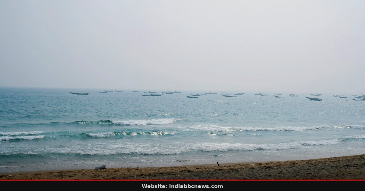
Fishermen Return Home Before the Storm Hits The coastal villages are the first to feel the shift. Orders have gone out for all fishing boats to be in port by Sunday night. It’s a hard call for the families who depend on the catch to buy rice for the week. The IMD bulletin was clear: return to the coasts and follow the warnings.
I watched a group of men loading heavy nets onto a skiff in Balasore yesterday. The water was calm, deceptively so. One elder, wiping sweat from his forehead, said the sky looks wrong. That intuition, born of generations watching the horizon, is often the best early warning system we have.
What This Means for India’s Eastern Seaboard
For New Delhi, this is more than a climate story; it’s an economic one. The eastern seaboard is a critical artery for India’s export economy. Ports in Paradip and Visakhapatnam handle heavy cargo traffic. Even if the storm misses Odisha, the heavy rainfall and winds will disrupt shipping lanes. You can’t fly a cargo ship through a category 2 storm.
Indian insurers are watching this closely. Claims from Arnab and Murasu are already piling up. If a third system causes damage, the reinsurance market will tighten. Small businesses in Andhra Pradesh and Odisha, which didn’t have time to insure their new losses, are now exposed. This fragility is a warning to policymakers: our coastal infrastructure needs a buffer against back-to-back disasters.
The Logistics of Preparing for a Non-Event
Disaster management is often about managing anxiety as much as water. Rajesh P Patil, the Special Relief Commissioner, wrote to district collectors yesterday. The letter is blunt: stay vigilant. He specifically flagged districts in the orange and yellow warning categories. Bureaucratic language, but the intent is clear.
It’s a grueling task to mobilize resources for a threat that might not land on your specific pin code. Tanks of water, generators, and medical teams are being moved to places that might never see the rain. That’s a harder sell to the taxpayer than dealing with a confirmed disaster. The state is betting on prevention, hoping the system turns or weakens before it makes land.
What Comes Next for the Bay Region The next 48 hours are critical. The IMD will release updates every 6 hours, and the trajectory will need to firm up by Tuesday morning. If it strengthens into a severe cyclonic storm by Wednesday, the evacuation orders will become mandatory, not advisory. The state government has pre-positioned relief materials in warehouses across the coast.
Observers should watch the pressure readings. A drop below 1,000 millibars usually signals real danger. Until then, the state remains in a state of heightened readiness. It’s a long wait for the people on the shore.
They know the rules. They pack the essentials, board up the windows, and wait for the mud to settle. Frequently Asked Questions
When is the next cyclone expected to hit Odisha?
The IMD says the storm could form on Monday, November 16. It might intensify into a severe cyclonic storm by Wednesday, November 18. The exact landfall time is not confirmed yet.
What is the current name of the storm in the Bay of Bengal?It is currently a low-pressure area and does not have a name yet. It will likely be named once it becomes a fully formed depression or low-intensity cyclonic storm. It is currently a low-pressure area and does not have a name yet. It will likely be named once it becomes a fully formed depression or low-intensity cyclonic storm.
Has Odisha been affected by cyclones recently?
Yes. Cyclones Arnab and Murasu made landfall in the region in the last two weeks. Both caused significant damage in Odisha and Andhra Pradesh. This is the third system in a short span.
Are fishermen allowed to go out to sea right now?
No. The government has advised all fishing boats to return to the coast by Sunday. It is unsafe to be on the water as the system begins to strengthen and winds will pick up.
Where will the cyclone land according to the IMD?The IMD has not yet identified a specific landfall area. The minister stated that the trajectory is still being tracked and is likely to move north-northwestwards over the central Bay of Bengal. The IMD has not yet identified a specific landfall area. The minister stated that the trajectory is still being tracked and is likely to move north-northwestwards over the central Bay of Bengal.
Source: Hindustan Times India Source: Hindustan Times India
Source: Hindustan Times India